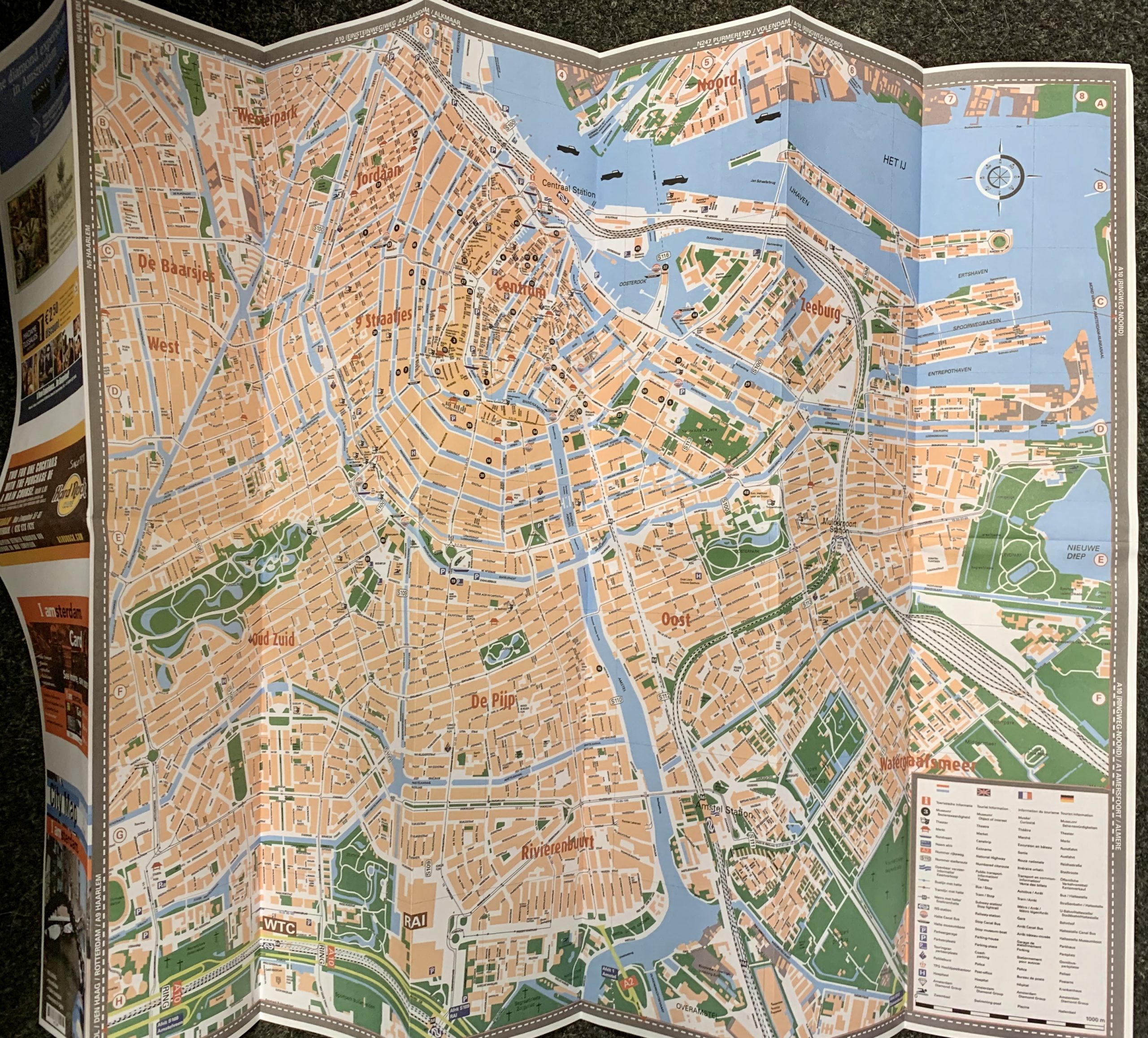
AMSTERDAM MAP. 2006. FROM GANDER’S SECOND EVER SHOW.
£275.00
Amsterdam: Annet Gelink Gallery, 2006
22 x 9.5cm, folding single sheet which opens to a 44 x 67.5cm, double sided full colour map seemingly of Amsterdam. This is a publication that was given to visitors to Gander’s second ever solo show – in the gallery setting with a large concrete wall there was a cardboard box, placed without any particular purpose, on the floor. That box contained the maps. At first glance these maps seem to be the type on sale at the Amsterdam tourist offices to assist tourists in navigating the city. They were indeed flawless reproductions of such maps − with the exception of a handful of newly added streets. These new streets and canals are taken from maps made between the late 19th and early 20th centuries, and although they did once actually exist, they have since been erased from the city’s landscape to make way for large municipal buildings as well as metro lines and parking spaces. Gander hoped that they would find their way into the reality of everyday life, meaning the possibility will arise that the general public will discover the deviations on the map without having any prior knowledge of the intervention or its history. Theoretically an unlimited edition but in practice these are very hard to find. VG+. Scarce.
Out of stock